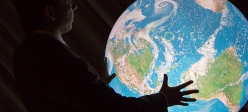

© UNISDR/R. Bajornas During the vote, 164 states voted in favor of a resolution aimed at using maps that more accurately reflect the size of continents. The UN supported the initiative of African countries to change the world map Culture and education
For centuries, the world map familiar to many generations has depicted Africa as much smaller than it actually is. On Friday, an overwhelming majority of countries at the United Nations supported an initiative to change that perception
The UN General Assembly has approved a proposal initiated by African countries to change the way the world is depicted on maps. During the vote, 164 states voted in favor of a resolution aimed at using maps that more accurately reflect the size of continents. The only voice against was the United States, which called this initiative part of a “radical ideological project.” Six countries – Estonia, Georgia, Lithuania, Moldova, Serbia and Ukraine – abstained.
The resolution does not ban the Mercator projection or establish a replacement for it. This projection is the world’s most used way of depicting a round Earth on a flat map, preserving accurate directions for easy navigation, but greatly distorting the size of areas, especially closer to the poles.
The UN resolution calls on governments, schools, international organizations and technology companies to use the Equal Earth projection and other so-called equal area maps in cases where relative sizes are important territories.
Behind this seemingly technical dispute lies a larger question: whether the map created for European sailors in the 16th century distorted not only geography but also historical understanding of Africa?
“Maps shape our understanding of the world,” Togo’s Foreign Minister Robert Doussy said before the vote. “They define education, fuel the imagination and influence collective perception.”
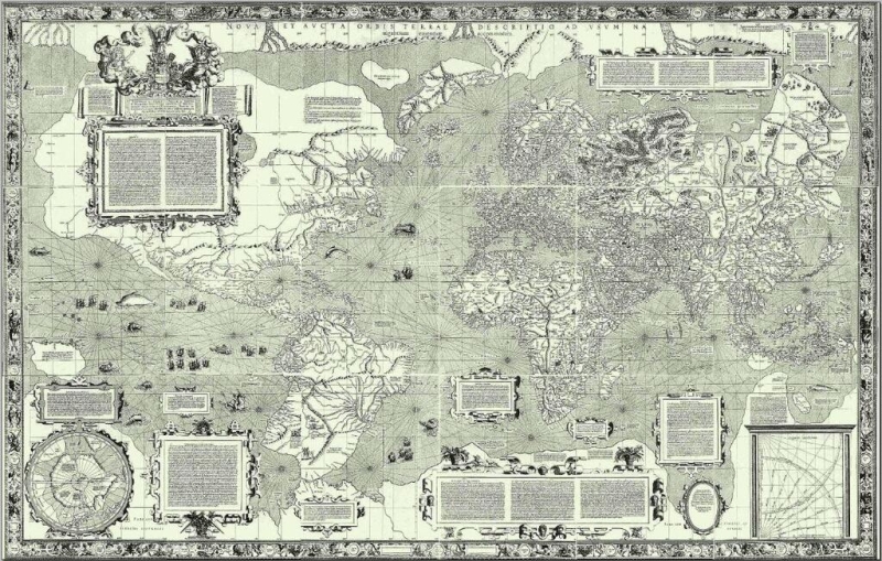
Public Domain World map of the 17th century, made in the Mercator projection.
Reduced continent
Flemish cartographer Gerardus Mercator developed his projection in 1569 to solve the practical problem of maritime navigation. Since the straight lines on his map corresponded to constant compass directions, sailors could use them to plot routes.
However, maintaining directions came at the expense of area precision. The further a territory is from the equator, the more it is enlarged. For example, Greenland on such a map might look roughly comparable in size to Africa, even though Africa is about 14 times larger. Northern Europe and North America, according to Mercator, also turn out to be significantly larger compared to regions located near the equator.
Despite its original navigational purpose, the Mercator projection is still widely used in educational, media, digital and official materials. The resolution said such distortions contributed to the “symbolic diminution” of Africa and supported an unbalanced view of the world.
Togo negotiated on behalf of a group of African countries backed by the African Union at the UN General Assembly. The resolution calls correcting such distortions “an act of restoring cognitive justice and reparation for past damage,” and cites Equal Earth, developed in 2018, as a projection that more accurately reflects the relative sizes of continents.
Doussy emphasized that this initiative is not aimed specifically at the Mercator projection, whose practical usefulness for navigation he recognized, and does not seek to impose a single vision world.
“A fair map does not change the geography of the world – it changes the way we see the world,” he emphasized.
USA: it is an “ideological project”
The United States saw political intent in this initiative.
“This resolution ridicules the work and purpose of this organization [meaning the UN – approx. ed.],” said the US representative. He said the initiative, presented as a harmless attempt to update map proportions, is part of a “much larger and radical ideological project.”
The American diplomat highlighted the resolution’s references to reparations and “cognitive justice,” calling such initiatives “an excrescence that has stuck to our work and the reason why this organization is losing trust.”
Russia, USA and France will look smaller
France took the opposite position. Hours before the vote, the country’s Foreign Minister Jean-Noël Barrault announced that France plans to abandon the Mercator projection on its world maps, joining a broad initiative promoted by the African Union.
As a result, France itself, like the United States and Russia, will appear smaller compared to the maps it is used to. This clearly shows the political side of the dispute. Equal area maps don’t make Africa bigger – they eliminate the exaggeration of size that the Mercator projection creates for areas closer to the poles.
The Problem of State Borders
Ukraine said it supported efforts to correct historical distortions affecting Africa and other parts of the Global South, but expressed objections to the way some maps using Equal Earth depict Russian-occupied Ukrainian territories.
The Ukrainian representative warned that approving the projection without sufficient guarantees could open a “Pandora’s box,” allowing the maps to create ambiguity around disputed territories.
The European Union supported the resolution but expressed similar concerns. Speaking on behalf of the EU, Ireland stressed that this measure concerns only the relative sizes of territories and does not affect issues of sovereignty, territorial status or internationally recognized borders. The EU representative also stated that support for the resolution does not automatically mean approval of the maps presented on the Equal Earth website.
The Mercator projection will not disappear anywhere
In essence, the General Assembly resolution recognizes a fundamental problem that no vote can solve. No projection can perfectly reproduce the curved surface of the Earth on a plane. Each sacrifices something – area, shape, distance or direction – and they are all suitable for different purposes.
The UN General Assembly Resolution is non-binding, and the Mercator projection is here to stay. But Friday’s vote showed overwhelming international support for an argument that African countries are increasingly making: that the choices embedded in the cards can influence how generations of people perceive the world around them.