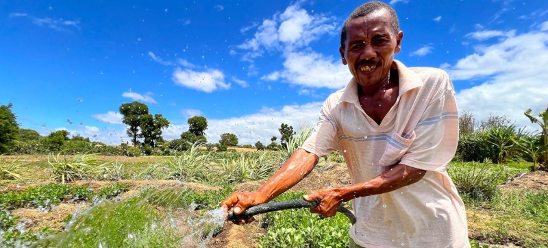

Access to water is a priority issue for the rural population of southern Madagascar. Water, information and peace: how they are related to each other? Climate and Environment
Developed by the Food and Agriculture Organization of the United Nations (FAO), the remote sensing tool WaPOR monitors the impact of conflict on agriculture and promotes equitable distribution of water resources. About this – in the material of our colleagues from FAO, prepared for World Water Day.
Water is the basis of all life, and therefore of any economy. It is not surprising that water resources and conflict are closely linked.
Conflict makes access to water difficult, but access to water itself can cause conflict. Increasing water scarcity and the effects of climate change are increasing the risk of conflict.
In such a situation, effective and sustainable water management is paramount, directly influencing the reduction of competition for water and conservation peace at the local level. And the starting point of this approach is the monitoring of water resources.
With the help of satellites in Earth orbit, we receive huge amounts of data every day, including about water resources, and remote sensing has become one of the main ways to fill the gap in data about hard-to-reach areas.
FAO’s WaPOR (Water Portal of Open Data) monitors agricultural land, including in conflict-affected areas, using open data from satellites. These data are freely available and used by FAO and national institutions to support initiatives aimed at preventing conflicts between different water users and identifying conflict-damaged infrastructure.
Here are four examples of how WaPOR data can be used to monitor water resources to reduce the risk of conflict and restore conflict-damaged access to this precious resource.
Syria
In 2019, FAO supported the Ministry of Water Resources (MoWR) and the Syrian General Directorate of Remote Sensing to use WaPOR data to assess conflict damage to national irrigation infrastructure. Dams, pumping stations, water treatment plants, field irrigation systems and other infrastructure were destroyed or seriously damaged.
DWR technical specialists, using WaPOR data, analyzed the areas served by irrigation infrastructure: they studied the dynamics of plant growth and water consumption by plants. Syria is a semi-desert climate, and the presence of signs of plants using water indicated that irrigated agriculture was not affected.
Sudan
In April 2023, armed conflict broke out in Sudan and continues to this day. Widespread insecurity and insecurity are hampering agricultural activities, including seed distribution, cultivation and cultivation of fields.
In this situation, to gain insight into the impact of conflict on agricultural production, FAO used WaPOR data to compare averages for the 2023 growing season with data from the previous five years. 51 percent. This was largely due to disruptions in markets and the financing mechanisms through which farmers purchase agricultural inputs. FAO has planned a distribution of high-quality seeds for August, which has improved the situation and enabled more farmers to plant on time.
This example shows that remote sensing data can help not only track the impact of conflict on agriculture, but also help plan humanitarian responses and evaluate the impact of interventions.
Mali
In Mali, FAO is working with the Ministry of Rural Development and the World Food Program to assess the impact of the current conflict on the country’s agricultural sector. WaPOR data and tools are used by the project to organize systematic assessments, especially in areas where it is unsafe to carry out follow-up activities.
Persistent insecurity coupled with water scarcity increases competition between local water users . Drought and desertification lead to drying up of ponds, rivers and wells.
Based on WaPOR data, the Water, Peace and Security Partnership (WPS), through its Global Early Warning tool, predicts the likelihood of conflicts arising from factors related to water, agriculture and overall tensions.
In Djenne, Mali, the WMB is using WaPOR data to support conflict resolution efforts, such as community dialogues, in areas with traditionally high competition for water resources.
Being able to assess the extent of damage caused by conflict to national agricultural investments is an important step in recovery planning. The results of the assessment formed the basis for plans for the reconstruction of the MWR and made it possible to understand how much funds would need to be raised.
Sri Lanka
The FAO project “Keeping Water Information Better” (KnoWat) was implemented in Sri Lanka to bring clarity to water tenure practices, which can also be a source of conflict. WaPOR data has helped produce a water resource inventory that can be used to analyze water access, water tenure, and water-related relationships. This is the first step towards understanding the distribution of water resources and the structure of water users. In order to achieve equitable distribution of water resources, it is necessary to know who can access it, how large the water supply is and how many stakeholders are using it.
In the Malwatu River basin in In Sri Lanka, periods of floods alternate with periods of water shortages; The situation is exacerbated by the effects of climate change and unsustainable water management, such as over-irrigation of crops. Using WaPOR data, irrigation managers in the Malwatu River basin collaborated with local farmers to assess the performance of the current growing season and plan for the future. By being able to monitor water productivity, agricultural extension specialists provide advice to farmers, warning them about the dangers of over-watering, relevant not only to the conservation of river basin resources, but also to farm productivity.
Smarter approaches to irrigation and a participatory process have resulted in increased water availability for all and increased crop yields, which in turn has reduced pressures and competition for water resources.